BC2A HQ
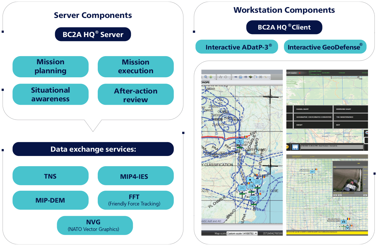
A C2 turnkey solution that addresses the operational needs of headquarters and command posts from tactical up to joint echelons, offering a standardized set of collaborative core and interoperability features.
It provides a complete set of collaborative C2 tools for staff, standardized infrastructure services common to every echelon from company to joint level, an open architecture for integrating third-party applications, sensors, equipment and installations, integrated data exchange with BC2A Platform and BC2A Leader, and interoperability with other NATO headquarters.
Standards Compliance
STANAG 2199 - Operational Document
COMPONENTS
Benefits
What changes for a headquarters running BC2A HQ®:
- Designed for use at multi-echelon HQ / CP level, with the same C2 core features for all echelons;
- Speeds up the military operational planning and decision-making process;
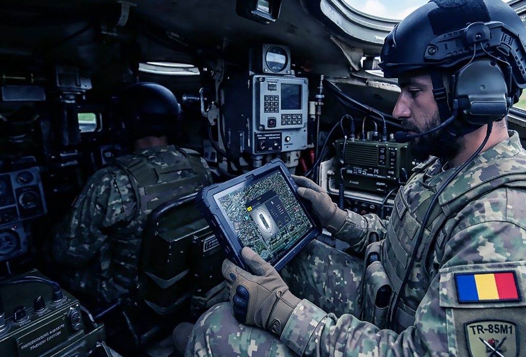
- Improves situational awareness at the tactical and operational levels;
- Provides the Recognized Ground Picture (RGP);
- Provides the Joint Operational Picture in a web browser;
- Provides data exchange with interministerial committees;
- Security based on Role-Based Access Control, with Single Sign-On;
- Provides a common and intuitive C2 software tool set for all functional communities;
- Proven C2 NATO interoperability: meets national and NATO interoperability requirements and implements NATO Joint Military Symbology;
- Offers standardized data exchange mechanisms over LAN/WAN and combat radio networks;
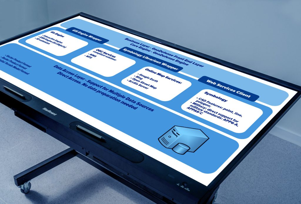
- Designed in an open architecture, with a C4I SDK framework for further independent development and for extending BC2A features, including integration with third-party systems;
- Ready for integration with other systems — ISTAR, fire control, other CS / CSS systems;
- Modular and scalable, can be implemented in successive phases;
- Flexible, configurable and adaptable to operational needs;
- System design according to NAF and FMN;
- Local language user interface;
- Effective cost of ownership compared to the solutions available on the market;
- Long-term product roadmap sustained with significant investment, quick response to clients’ and partners’ requests, and openness to cooperation with domestic and international partners.
System Highlights
Situational awareness
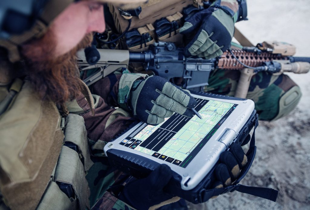
>Displays near real-time information over GIS layers (COP) and other operational documents, about:
- friendly and neutral forces;
- enemy forces;
- events, MSRs, obstacles and other operational elements.
GIS capabilities
>- Uses georeferenced raster maps, vector maps, altimetry terrain models and georeferenced aerial and satellite photographs;
- Uses all common coordinate and projection systems used by NATO;
- Terrain analysis: Line of Sight, Radial Line of Sight and Viewshed;
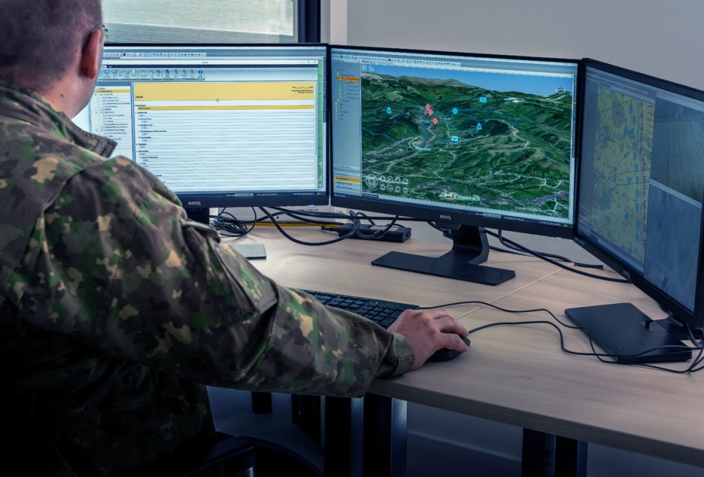
- Displays terrain and the operational situation in a 3D scene for analysis, with the possibility to overlap and synchronize it with the 2D tactical situation;
- Performs topo-geodetic calculations;
- Calculates the optimal path between two points on the map;
- Adjusts the contrast, brightness and grayscale display of the map.
Update of own position
>- Provides update of own position based on GPS information, coming from a radio GPS receiver or from other GPS receivers.
Operational documents
>- Manages an unlimited number of documents — analysis, estimations, matrices, situational awareness, CONOPS, reports, requests, plans and orders — while providing predefined templates (OPLAN, OPORD, FRAGO, WARNO, etc.) according to STANAG 2199 / 2014;
- An operational graphic overlay can be associated with every paragraph;
- Allows defining and saving new templates, either STANAG 2199 / 2014 or non-standard.
Scenarios and courses of action
>- The courses of action are created based on scenarios;
- More than one ECOA can be associated with each scenario, and more than one COA with each ECOA.
ORBAT / TASKORG
>- Provides an editor tool for creating and editing ORBATs and TASKORGs;
- ORBATs and TASKORGs can be exported in XML format.
Reports and requests
>- Generates, edits, submits, transmits and receives reports and requests in accordance with the ADatP-3 standard;
- Ready for the integration of other types of custom reports and requests.
Specific capabilities for functional areas
>Includes software tools for:
- intelligence preparation of the operational environment / battlespace;
- course of action analysis;
- operations planning;
- combat support and combat service support.
Holdings management
>- Aggregates current holdings and generates the operational status in real time.
Standardized data exchange over radio
>- Provides a reliable Data Transport Protocol service over radio (HF, VHF, multiband), LAN and WAN, to any application that needs to exchange data over networks with a low exchange rate;
- QoS: IP-level priority policy, ordering, expiry time;
- Proprietary reliable UDP: acknowledge mechanism, congestion avoidance, dynamic adjustment of communication parameters;
- Data compression;
- Configurable parameters for each communication media type;
- Ready for integration, due to its SOA-based architecture.
Tactical chat
>- Allows sending and receiving text messages and files of all types;
- Ensures messaging based on approved priority levels and receivers’ groups;
- Alerts and contact with the enemy.
Alerts
>- Allows displaying alerts and sending them to other C2 systems: Contact Alert, AIR and CBRN;
- Allows configuring proximity alerts.
Interoperability
>- MIP baseline: the data model used is JC3IEDM 3.1 (STANAG 5525) and the MIM 5.2 data model;
- Enables data exchange with multinational headquarters via MIP-DEM 3.1 and MIP4-IES protocols;
- Provides an NFFI/FFI (NATO Friendly Force Information) hub service, in accordance with STANAG 5527;
- Provides NATO Vector Graphics interfaces to NATO systems for sharing and using operational overlays and Common Operational Pictures;
- The ADatP-3 editor provides all mission-formatted templates for baselines 12, 12.2 and 14.
Collaborative work
>- Provides a collaborative work environment for commanders and their staff, based on the “need to know” principle;
- Uses RBAC and Single Sign-On mechanisms.
After-action review
>- Uses history and playback of the situation for after-action review.
System requirements
>BC2A HQ® Server — minimum hardware:
- CPU: Intel, 2.4 GHz;
- 10 core processors;
- Memory: minimum 16 GB RAM (32 GB RAM recommended);
- Space on HDD: minimum 200 GB.
BC2A HQ® Server — software:
- OS: Microsoft Windows Server 2019 or newer;
- Active Directory;
- Microsoft .Net Framework 4.8;
- Microsoft SQL Server 2019 or newer (including Express Edition);
- BC2A TNS.
BC2A HQ® Client — hardware:
- Processor: minimum 2 GHz;
- Memory: minimum 2 GB RAM (64-bit);
- Space on hard disk: minimum 100 GB (64-bit);
- Graphics card: Microsoft DirectX 9 graphics device with WDDM driver.
BC2A HQ® Client — software and communications:
- OS: Microsoft Windows 8.1 or newer;
- Microsoft .Net Framework 4.8;
- Microsoft SQL Compact 4.0;
- Combat network radio environment and LAN/WAN networks.
References
>BC2A HQ® has been tested in various interoperability exercises and working groups:
- Coalition Warrior Interoperability Demonstration — 2007–2010;
- Coalition Warrior Interoperability eXploration, eXperimentation, eXamination eXercise (CWIX) — 2011–2026;
- MIP working group activities for interoperability.
SEND US A MESSAGE
Fill out the form below to get acces to our whitepaper